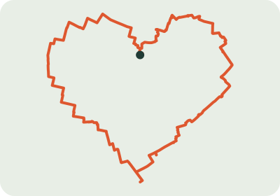
Heart-shaped running route in Vienna
15.3 km
A heart through Vienna: about 15.3 km of GPS art on real streets, starting in the Josefstadt area. The heart shape gives your running track a recognisable outline.
GPS ART · RUNNING ART · SHAPERUN
ShapeRun helps you plan a running route whose GPS track draws a shape. Choose a place, a motif and a target distance. The generator looks for suitable streets and paths; a dense network usually offers better possibilities.
Plan your own route ↗15.3 km
A heart through Vienna: about 15.3 km of GPS art on real streets, starting in the Josefstadt area. The heart shape gives your running track a recognisable outline.
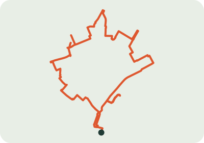
4.6 km
An autumn leaf GPS art route in Salzburg: about 4.6 km along the existing street and path network. A seasonal idea for a short run with a distinctive track.
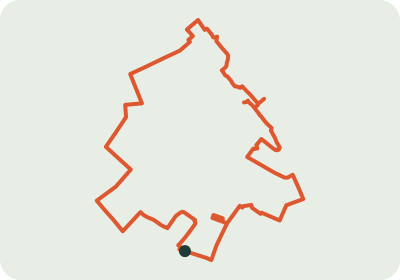
4.8 km
A Christmas tree for your festive run in Wiener Neustadt: about 4.8 km. The aligned preview reveals the tree shape; the planner also lets you switch back to north-up.
These examples have been visually reviewed for their shape, but have not been checked on foot. Closures, access and path conditions may differ from map data. Check the route before running. The preview aligns the shape; north is not always at the top.
You plan and follow a route whose recorded GPS track creates a picture. It is also called running art or GPS drawing.
You can run a suitable route and record your activity with a tracking app. ShapeRun exports GPX files but has no direct Strava integration.
No. The local street and path network determines which shapes are recognisable. Try a different starting area, distance or simpler motif if results are unsuitable.